Because of its varied terrain, the Pincushion Trail system offers many acres and miles of trails. Trails for hikers, bikers, skiers, fat-tire bikers, birders, and more! Plus, it’s high vantage point provides a spectacular overlook of the town of Grand Marais. For hikers, the 15 miles of Pincushion Mountain’s trails offer loops to Lake Superior’s North Shore, the Devil’s Track River, and more! Keep an eye out along the way for countless birch, aspen, and pine trees. Hikers can use either the cross-country ski or biking trails but must keep alert at all times.
There are about six miles of single-track trails that mountain bikers can enjoy starting from the trailhead. The trails vary from easy to moderate and some even intersect the cross-country ski trails. Most of the trails have been developed over time to accompany a smooth ride. Although the trails are developed riders should still be cautious as conditions often change. If you’re up for the challenge, many people fat bike the Pincushion Trail System.
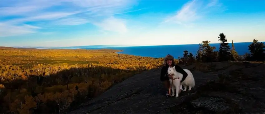
The most popular trail is the Pincushion Mountain Overlook which brings you to the top of the mountain. The overlook provides a stunning view of Lake Superior and the North Shore. Keep an eye out for pine martens, wolves, and the occasional moose as you stroll along the trails. If you are hiking in the spring or fall we recommend you wear water-resistant shoes and/or boots or your feet will get a little wet.
Getting There
Follow the Gunflint Trail/County Road 12 north (away from Lake Superior) from Grand Marais for 2.5 miles and turn right onto Pincushion Drive. You will find a parking lot and the trailhead about .25 miles down Pincushion Drive.